


Plampied Givaudins

jlrayon
User
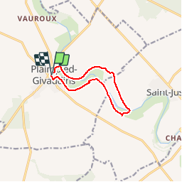

Length
8.9 km

Max alt
157 m

Uphill gradient
81 m
Km-Effort
10 km

Min alt
135 m

Downhill gradient
81 m
Boucle
Yes
Creation date :
2016-08-16 00:00:00.0
Updated on :
2016-08-16 00:00:00.0
2h10
Difficulty : Medium

FREE GPS app for hiking
 SityTrail
IGN / Geographical institutes
SityTrail Plus
The world is yours!
About
Trail Walking of 8.9 km to be discovered at Centre-Loire Valley, Cher, Plaimpied-Givaudins. This trail is proposed by jlrayon.
Description
Promenade dans les marais autours de Plaimpieds


Positioning
Country:
France
Region :
Centre-Loire Valley
Department/Province :
Cher
Municipality :
Plaimpied-Givaudins
Location:
Unknown
Start:(Dec)
Start:(UTM)
458530 ; 5205087 (31T) N.
Comments