Trail Mountain bike Saumane - corniche des cevennes - Photo

corniche des cevennes

 scombe
scombe

User

© OpenStreetMap contributors
Length
Length
33 km
Max alt
Max alt
705 m
Uphill gradient
Uphill gradient
794 m
Km-Effort
Km-Effort  
43 km
Min alt
Min alt
201 m
Downhill gradient
Downhill gradient
795 m
Boucle
Boucle
Yes
Creation date :
2016-08-14 00:00:00.0
Updated on :
2016-08-14 00:00:00.0

(0 Reviews)

Mountain bike
Mountain bike
2h08
Difficulty : Medium

Scan this QR Code to open this trail in the SityTrail application

FREE GPS app for hiking

Logo SityTrail SityTrail

IGN / Geographical institutes

Download SityTrail from the App Store Download SityTrail from Google Play

Logo SityTrail SityTrail World

The world is yours!

Download SityTrail from the App Store Download SityTrail from Google Play Download SityTrail on Huawei AppGallery

About

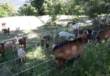
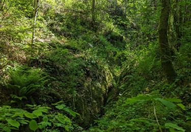
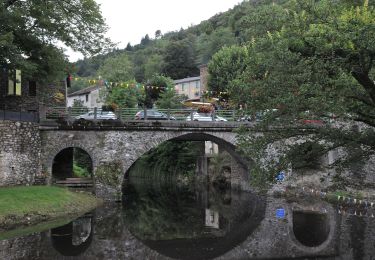
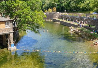
Trail Mountain bike of 33 km to be discovered at Occitania, Gard, Saumane. This trail is proposed by scombe.

Description

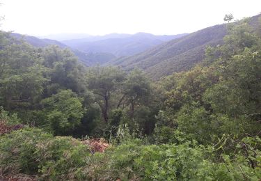
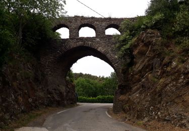
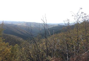
saumane / st maurice de toulsque / corniche des cevennes / st jean du gard

Elevation profile

Positioning

Country:
France
Region :
Occitania
Department/Province :
Gard
Municipality :
Saumane
Location:
Unknown
Start:(UTM)
561709 ; 4884656 (31T) N.

Trails nearby

Trail Walking Les Plantiers - Sentier de Saint Marcel de Fontfouillouse -  Les Plantiers - Photo
Walking
tracegps

Walking

Very difficult
(1)
Les Plantiers, Occitania, Gard, France
13.6 km | 21 km-effort
4h 0min
Yes
Trail Walking Saumane - Exil / pont des chèvres  - Photo
Walking
GUIDE
nadinebondoux

Walking

Difficult
Saumane, Occitania, Gard, France
17.3 km | 27 km-effort
5h 53min
Yes
Trail Walking Peyrolles - la Diligence  - Photo
Walking
GUIDE
nadinebondoux

Walking

Medium
Peyrolles, Occitania, Gard, France
15.3 km | 0 m-effort
4h 47min
Yes
Trail Walking Les Plantiers - vallée Borgne - Photo
Walking
GUIDE
nadinebondoux

Walking

Difficult
Les Plantiers, Occitania, Gard, France
25 km | 36 km-effort
6h 15min
Yes
Trail Walking Les Plantiers - Les Plantiers et st Marcel de Fontfouillouse - Photo
Walking
GUIDE
randotines

Walking

Difficult
(1)
Les Plantiers, Occitania, Gard, France
13.6 km | 21 km-effort
4h 33min
Yes
Trail Walking L'Estréchure - sentier du soult -  - Photo
Walking
campingmasdelacam

Walking

Difficult
L'Estréchure, Occitania, Gard, France
10.3 km | 17.1 km-effort
3h 52min
Yes
Trail Walking Soudorgues - La Vallée Borgne - Photo
Walking
ARVIEU

Walking

Difficult
Soudorgues, Occitania, Gard, France
14.6 km | 22 km-effort
5h 30min
Yes
Trail On foot Les Plantiers - Sentier de Fontfouillouse - Photo
On foot
PRO

On foot

Easy
Les Plantiers, Occitania, Gard, France
9.2 km | 15.2 km-effort
3h 27min
No
Trail Walking Les Plantiers - les plantiers, abbaye de Fontfouillouse  - Photo
Walking
francislassauce

Walking

Medium
Les Plantiers, Occitania, Gard, France
7.4 km | 11.8 km-effort
3h 16min
Yes


Close
My subscriptions