


La montagne noire d'Ouest en Est

Jean-Phi81
User
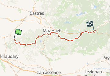

Length
98 km

Max alt
1155 m

Uphill gradient
2350 m
Km-Effort
130 km

Min alt
295 m

Downhill gradient
2387 m
Boucle
No
Creation date :
2016-08-19 00:00:00.0
Updated on :
2016-08-19 00:00:00.0
27h07
Difficulty : Difficult

FREE GPS app for hiking
 SityTrail
IGN / Geographical institutes
SityTrail Plus
The world is yours!
About
Trail Walking of 98 km to be discovered at Occitania, Tarn, Sorèze. This trail is proposed by Jean-Phi81.
Positioning
Country:
France
Region :
Occitania
Department/Province :
Tarn
Municipality :
Sorèze
Location:
Unknown
Start:(Dec)
Start:(UTM)
422224 ; 4809646 (31T) N.
Comments