


Mont Viso: Vallanta-Giacoletti

AlainPoels
User
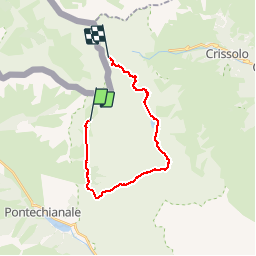

Length
21 km

Max alt
2769 m

Uphill gradient
1432 m
Km-Effort
39 km

Min alt
1916 m

Downhill gradient
1117 m
Boucle
No
Creation date :
2016-08-22 00:00:00.0
Updated on :
2019-04-26 19:25:03.865
7h57
Difficulty : Difficult

FREE GPS app for hiking
 SityTrail
IGN / Geographical institutes
SityTrail Plus
The world is yours!
About
Trail Walking of 21 km to be discovered at Piemont, Cuneo, Pontechianale. This trail is proposed by AlainPoels.
Description
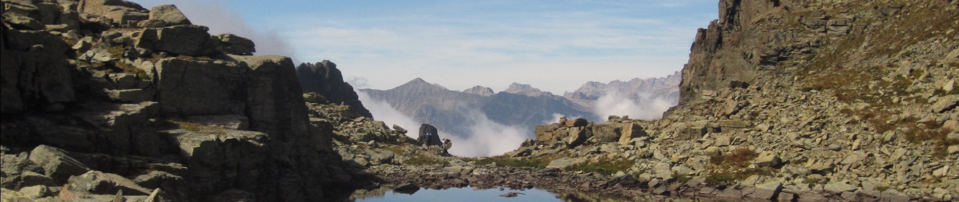
Magnifique.
Photos


Positioning
Country:
Italy
Region :
Piemont
Department/Province :
Cuneo
Municipality :
Pontechianale
Location:
Unknown
Start:(Dec)
Start:(UTM)
346452 ; 4947645 (32T) N.
Comments