


Trehorenteuc

legallo
User
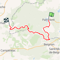

Length
21 km

Max alt
243 m

Uphill gradient
376 m
Km-Effort
26 km

Min alt
89 m

Downhill gradient
439 m
Boucle
No
Creation date :
2016-08-24 00:00:00.0
Updated on :
2016-08-24 00:00:00.0
5h50
Difficulty : Unknown

FREE GPS app for hiking
 SityTrail
IGN / Geographical institutes
SityTrail Plus
The world is yours!
About
Trail Walking of 21 km to be discovered at Brittany, Ille-et-Vilaine, Paimpont. This trail is proposed by legallo.
Positioning
Country:
France
Region :
Brittany
Department/Province :
Ille-et-Vilaine
Municipality :
Paimpont
Location:
Unknown
Start:(Dec)
Start:(UTM)
561605 ; 5318746 (30U) N.
Comments