


Lac de Peyre (col de la Colombière).

AndreLACOMBE
User
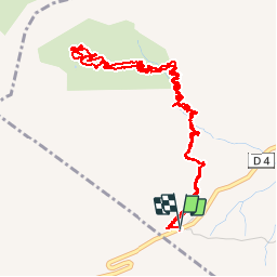

Length
7.2 km

Max alt
2098 m

Uphill gradient
484 m
Km-Effort
13.6 km

Min alt
1614 m

Downhill gradient
485 m
Boucle
Yes
Creation date :
2016-08-25 00:00:00.0
Updated on :
2016-08-25 00:00:00.0
5h12
Difficulty : Difficult

FREE GPS app for hiking
 SityTrail
IGN / Geographical institutes
SityTrail Plus
The world is yours!
About
Trail Walking of 7.2 km to be discovered at Auvergne-Rhône-Alpes, Upper Savoy, Le Reposoir. This trail is proposed by AndreLACOMBE.
Description
Au départ du col, le sentier très caillouteux et très escarpé nous conduit doucement au lac. Superbe vue sur le Mont-blanc.
Positioning
Country:
France
Region :
Auvergne-Rhône-Alpes
Department/Province :
Upper Savoy
Municipality :
Le Reposoir
Location:
Unknown
Start:(Dec)
Start:(UTM)
304490 ; 5096269 (32T) N.
Comments