


canal midi_rigole_st fereol

m261212
User
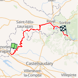

Length
47 km

Max alt
617 m

Uphill gradient
718 m
Km-Effort
55 km

Min alt
194 m

Downhill gradient
309 m
Boucle
No
Creation date :
2017-08-26 00:00:00.0
Updated on :
2017-08-26 00:00:00.0
3h10
Difficulty : Medium

FREE GPS app for hiking
 SityTrail
IGN / Geographical institutes
SityTrail Plus
The world is yours!
About
Trail Cycle of 47 km to be discovered at Occitania, Aude, Montferrand. This trail is proposed by m261212.
Positioning
Country:
France
Region :
Occitania
Department/Province :
Aude
Municipality :
Montferrand
Location:
Unknown
Start:(Dec)
Start:(UTM)
404329 ; 4800823 (31T) N.
Comments