


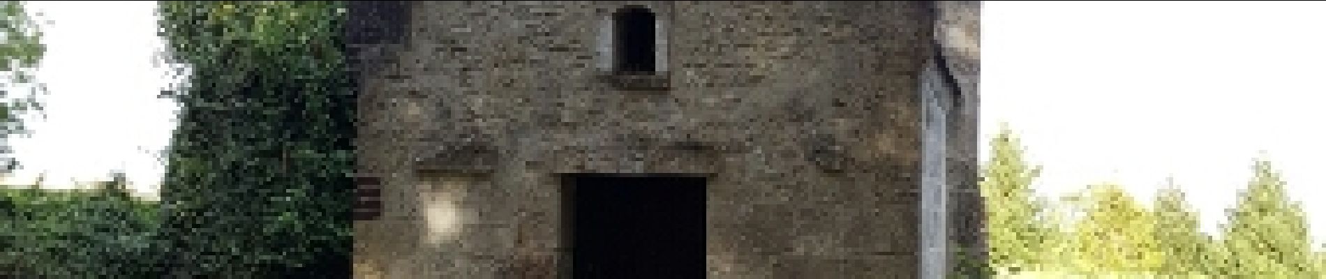
mont calvaire

fitz2014
User
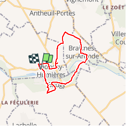

Length
11.7 km

Max alt
91 m

Uphill gradient
157 m
Km-Effort
13.8 km

Min alt
42 m

Downhill gradient
158 m
Boucle
Yes
Creation date :
2016-09-03 00:00:00.0
Updated on :
2016-09-03 00:00:00.0
2h54
Difficulty : Easy

FREE GPS app for hiking
 SityTrail
IGN / Geographical institutes
SityTrail Plus
The world is yours!
About
Trail Walking of 11.7 km to be discovered at Hauts-de-France, Oise, Monchy-Humières. This trail is proposed by fitz2014.
Photos


Positioning
Country:
France
Region :
Hauts-de-France
Department/Province :
Oise
Municipality :
Monchy-Humières
Location:
Unknown
Start:(Dec)
Start:(UTM)
481649 ; 5479756 (31U) N.
Comments