


Orleat_Girauds_Faures_1

jagarnier
User GUIDE
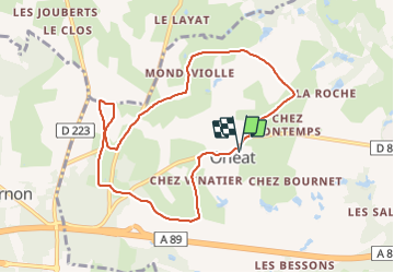

Length
8.7 km

Max alt
398 m

Uphill gradient
66 m
Km-Effort
9.6 km

Min alt
356 m

Downhill gradient
66 m
Boucle
Yes
Creation date :
2016-09-09 00:00:00.0
Updated on :
2023-09-30 06:37:23.61
2h30
Difficulty : Easy

FREE GPS app for hiking
 SityTrail
IGN / Geographical institutes
SityTrail Plus
The world is yours!
About
Trail Walking of 8.7 km to be discovered at Auvergne-Rhône-Alpes, Puy-de-Dôme, Orléat. This trail is proposed by jagarnier.
Description
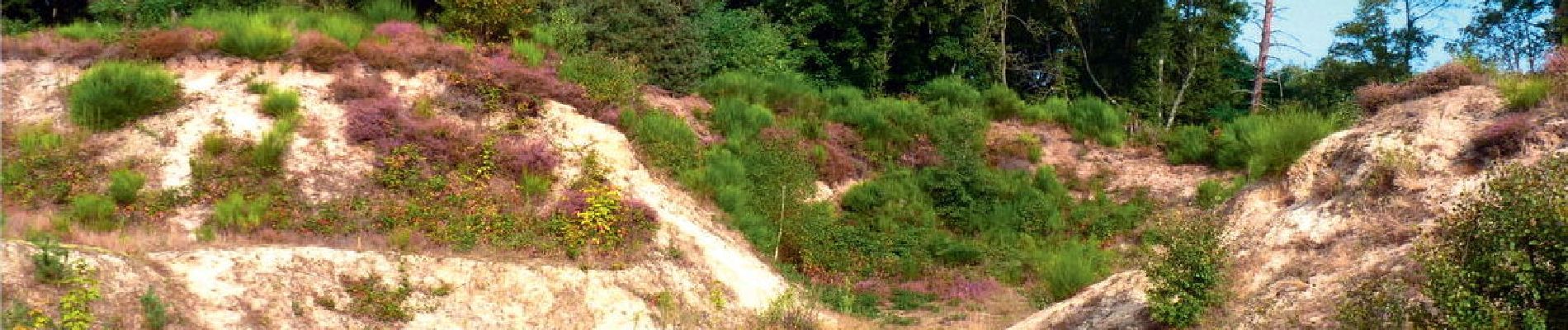
Une balade qui vous amènera sur le site des dunes continentales. Un patrimoine unique en Europe classé site "natura 2000".
Photos

Positioning
Country:
France
Region :
Auvergne-Rhône-Alpes
Department/Province :
Puy-de-Dôme
Municipality :
Orléat
Location:
Unknown
Start:(Dec)
Start:(UTM)
532726 ; 5078674 (31T) N.
Comments