piegon

pierre.chau
User

Length
12.8 km

Max alt
836 m

Uphill gradient
534 m
Km-Effort
19.9 km

Min alt
342 m

Downhill gradient
531 m
Boucle
Yes
Creation date :
2016-09-11 00:00:00.0
Updated on :
2016-09-11 00:00:00.0
4h16
Difficulty : Easy

FREE GPS app for hiking
 SityTrail
IGN / Geographical institutes
SityTrail Plus
The world is yours!
About
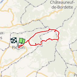
Trail Walking of 12.8 km to be discovered at Auvergne-Rhône-Alpes, Drôme, Piégon. This trail is proposed by pierre.chau.
Positioning
Country:
France
Region :
Auvergne-Rhône-Alpes
Department/Province :
Drôme
Municipality :
Piégon
Location:
Unknown
Start:(Dec)
Start:(UTM)
669655 ; 4907498 (31T) N.
Comments