


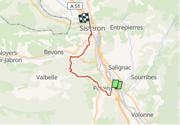
Rome-33-Aubignosc-Sisteron-20160912

patrickdanilo
User

Length
16.1 km

Max alt
1032 m

Uphill gradient
722 m
Km-Effort
26 km

Min alt
468 m

Downhill gradient
712 m
Boucle
No
Creation date :
2018-02-15 00:00:00.0
Updated on :
2022-11-16 15:57:16.345
5h23
Difficulty : Very difficult

FREE GPS app for hiking
 SityTrail
IGN / Geographical institutes
SityTrail Plus
The world is yours!
About
Trail Walking of 16.1 km to be discovered at Provence-Alpes-Côte d'Azur, Alpes-de-Haute-Provence, Aubignosc. This trail is proposed by patrickdanilo.
Description
ALTA-13-N°0312F33-GR653D
Photos


Positioning
Country:
France
Region :
Provence-Alpes-Côte d'Azur
Department/Province :
Alpes-de-Haute-Provence
Municipality :
Aubignosc
Location:
Unknown
Start:(Dec)
Start:(UTM)
737540 ; 4890562 (31T) N.
Comments