


St Lucien la boissiere école

topophil
User
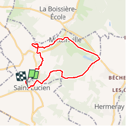

Length
12.8 km

Max alt
182 m

Uphill gradient
123 m
Km-Effort
14.4 km

Min alt
120 m

Downhill gradient
124 m
Boucle
Yes
Creation date :
2016-09-20 00:00:00.0
Updated on :
2016-09-20 00:00:00.0
2h36
Difficulty : Unknown

FREE GPS app for hiking
 SityTrail
IGN / Geographical institutes
SityTrail Plus
The world is yours!
About
Trail Walking of 12.8 km to be discovered at Centre-Loire Valley, Eure-et-Loir, Saint-Lucien. This trail is proposed by topophil.
Positioning
Country:
France
Region :
Centre-Loire Valley
Department/Province :
Eure-et-Loir
Municipality :
Saint-Lucien
Location:
Unknown
Start:(Dec)
Start:(UTM)
398345 ; 5389281 (31U) N.
Comments