


Le rocher de mallaval

jphugon
User
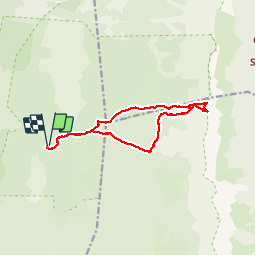

Length
12.1 km

Max alt
2083 m

Uphill gradient
714 m
Km-Effort
22 km

Min alt
1373 m

Downhill gradient
713 m
Boucle
Yes
Creation date :
2016-09-23 00:00:00.0
Updated on :
2016-09-23 00:00:00.0
7h00
Difficulty : Difficult

FREE GPS app for hiking
 SityTrail
IGN / Geographical institutes
SityTrail Plus
The world is yours!
About
Trail Walking of 12.1 km to be discovered at Auvergne-Rhône-Alpes, Drôme, Saint-Agnan-en-Vercors. This trail is proposed by jphugon.
Positioning
Country:
France
Region :
Auvergne-Rhône-Alpes
Department/Province :
Drôme
Municipality :
Saint-Agnan-en-Vercors
Location:
Unknown
Start:(Dec)
Start:(UTM)
694507 ; 4976729 (31T) N.
Comments