


toutour fontingon adapté

petipeto
User
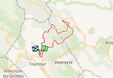

Length
15.6 km

Max alt
768 m

Uphill gradient
294 m
Km-Effort
19.5 km

Min alt
671 m

Downhill gradient
305 m
Boucle
Yes
Creation date :
2016-09-24 00:00:00.0
Updated on :
2016-09-24 00:00:00.0
3h21
Difficulty : Unknown

FREE GPS app for hiking
 SityTrail
IGN / Geographical institutes
SityTrail Plus
The world is yours!
About
Trail Walking of 15.6 km to be discovered at Provence-Alpes-Côte d'Azur, Var, Tourtour. This trail is proposed by petipeto.
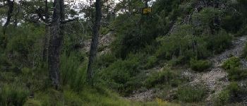
Photos


Positioning
Country:
France
Region :
Provence-Alpes-Côte d'Azur
Department/Province :
Var
Municipality :
Tourtour
Location:
Unknown
Start:(Dec)
Start:(UTM)
282490 ; 4830547 (32T) N.
Comments