


CHX ZRMT Étape 6 d'Arolla à La sage

jeff2
User
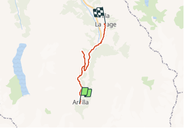

Length
17.3 km

Max alt
2192 m

Uphill gradient
696 m
Km-Effort
28 km

Min alt
1442 m

Downhill gradient
1095 m
Boucle
No
Creation date :
2016-09-25 00:00:00.0
Updated on :
2016-09-25 00:00:00.0
5h34
Difficulty : Easy

FREE GPS app for hiking
 SityTrail
IGN / Geographical institutes
SityTrail Plus
The world is yours!
About
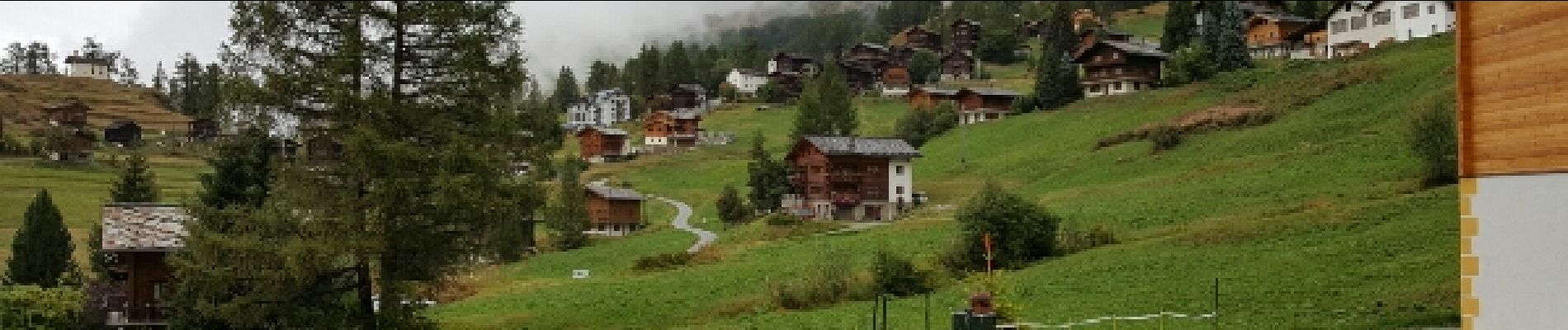
Trail Walking of 17.3 km to be discovered at Valais/Wallis, Hérens, Evolène. This trail is proposed by jeff2.
Description
Tellement fastoche que je me suis perdu !
Photos


23 photos in total. Please click on a photo to see them all in the gallery.
Positioning
Country:
Switzerland
Region :
Valais/Wallis
Department/Province :
Hérens
Municipality :
Evolène
Location:
Unknown
Start:(Dec)
Start:(UTM)
382328 ; 5097904 (32T) N.
Comments