Trail Walking Burthecourt-aux-Chênes - Burthecourt - Azelot - Manoncourt - Photo

Burthecourt - Azelot - Manoncourt

© OpenStreetMap contributors
Length
Length
12.2 km
Max alt
Max alt
333 m
Uphill gradient
Uphill gradient
110 m
Km-Effort
Km-Effort  
13.6 km
Min alt
Min alt
253 m
Downhill gradient
Downhill gradient
110 m
Boucle
Boucle
Yes
Creation date :
2016-10-02 00:00:00.0
Updated on :
2016-10-02 00:00:00.0

(0 Reviews)

Walking
Walking
3h01
Difficulty : Very easy

Scan this QR Code to open this trail in the SityTrail application

FREE GPS app for hiking

Logo SityTrail SityTrail

IGN / Geographical institutes

Download SityTrail from the App Store Download SityTrail from Google Play

Logo SityTrail SityTrail World

The world is yours!

Download SityTrail from the App Store Download SityTrail from Google Play Download SityTrail on Huawei AppGallery

About

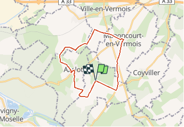
Trail Walking of 12.2 km to be discovered at Grand Est, Meurthe-et-Moselle, Burthecourt-aux-Chênes. This trail is proposed by DanielROLLET.

Description

28.09.2016 Reco ASPV avec Marie - Grand beau temps
02.10.2016 Rando ASPV 13 participants - Couvert sans pluie, un peu de vent.
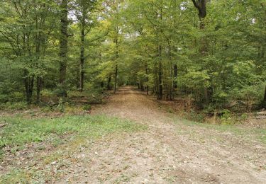
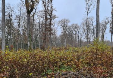
Circuit déconseillé par trés forte chaleur (pas d'arbres) et par trés mauvauis temps (pluie   vent) Quelques chemins seront trés gras par temps humide. sentiers empruntés par cavaliers donc défoncés par endroits.
2 abris : 1 à Azelot avec un fontaine prés de l'église et un à Manoncourt en Vermois prés de l'ancien lavoir.
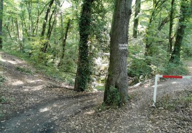
Circuit avec une trés belle vue sur la Vallée de la Meurthe et Nancy, du Plateau de Ludres au Plateau de Malzéville.
Durée 3h05

Elevation profile

Positioning

Country:
France
Region :
Grand Est
Department/Province :
Meurthe-et-Moselle
Municipality :
Burthecourt-aux-Chênes
Location:
Unknown
Start:(UTM)
297080 ; 5384757 (32U) N.

Trails nearby

Trail On foot Fléville-devant-Nancy - Fléville-devant-Nancy et son château - Photo
On foot
PRO

On foot

Easy
Fléville-devant-Nancy, Grand Est, Meurthe-et-Moselle, France
7.9 km | 9.4 km-effort
2h 8min
Yes
Trail Mountain bike Tonnoy - Menil-Benney - Photo
Mountain bike
regish54

Mountain bike

Easy
Tonnoy, Grand Est, Meurthe-et-Moselle, France
13.1 km | 16.9 km-effort
1h 11min
No
Trail Walking Flavigny-sur-Moselle - Flavigny sur moselle - Photo
Walking
Jacques-WIRTH

Walking

Very easy
Flavigny-sur-Moselle, Grand Est, Meurthe-et-Moselle, France
10.1 km | 11 km-effort
3h 1min
Yes
Trail Walking Flavigny-sur-Moselle - Flavigny 2  12 100m + 197m  - Photo
Walking
DanielROLLET

Walking

Very easy
Flavigny-sur-Moselle, Grand Est, Meurthe-et-Moselle, France
11.9 km | 14.1 km-effort
3h 13min
Yes
Trail Mountain bike Flavigny-sur-Moselle - FLAVIGNY 2015-10-12 - Photo
Mountain bike
DENOMME

Mountain bike

Medium
(2)
Flavigny-sur-Moselle, Grand Est, Meurthe-et-Moselle, France
28 km | 34 km-effort
2h 37min
No
Trail Mountain bike Flavigny-sur-Moselle - 16km-decouverte - Photo
Mountain bike
regish54

Mountain bike

Easy
Flavigny-sur-Moselle, Grand Est, Meurthe-et-Moselle, France
12.2 km | 16.2 km-effort
1h 17min
No
Trail Walking Flavigny-sur-Moselle - Flavgny - la boucle verte - Photo
Walking
jean-marie.parachini

Walking

Easy
Flavigny-sur-Moselle, Grand Est, Meurthe-et-Moselle, France
9.5 km | 11.5 km-effort
4h 51min
Yes
Trail Walking Flavigny-sur-Moselle - FLAVIGNY SUR MOSELLE - LA BOUCLE VERTE - Photo
Walking
jean-marie.parachini

Walking

Easy
Flavigny-sur-Moselle, Grand Est, Meurthe-et-Moselle, France
9.6 km | 11.6 km-effort
4h 35min
Yes
Trail Walking Flavigny-sur-Moselle - Flavigny 13 010m +205m - Photo
Walking
DanielROLLET

Walking

Difficult
Flavigny-sur-Moselle, Grand Est, Meurthe-et-Moselle, France
13 km | 15.7 km-effort
3h 5min
Yes


Close
My subscriptions