


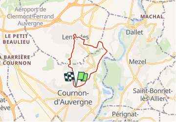
Cournon_Allier_Puy_Bane

jagarnier
User GUIDE

Length
9.4 km

Max alt
531 m

Uphill gradient
253 m
Km-Effort
12.8 km

Min alt
330 m

Downhill gradient
260 m
Boucle
Yes
Creation date :
2016-11-14 00:00:00.0
Updated on :
2025-04-11 15:48:33.846
2h45
Difficulty : Medium

FREE GPS app for hiking
 SityTrail
IGN / Geographical institutes
SityTrail Plus
The world is yours!
About
Trail Walking of 9.4 km to be discovered at Auvergne-Rhône-Alpes, Puy-de-Dôme, Cournon-d'Auvergne. This trail is proposed by jagarnier.
Description
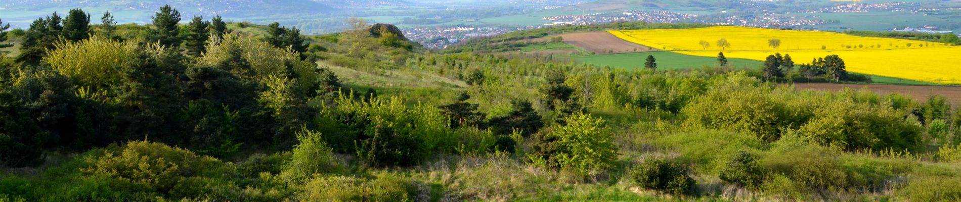
Cette randonnée est un havre de tranquillité, scandé par les puys de Bane et d'Anzelle, alors que l'Allier déroule ses méandres sur leur limite orientale.
Photos

Positioning
Country:
France
Region :
Auvergne-Rhône-Alpes
Department/Province :
Puy-de-Dôme
Municipality :
Cournon-d'Auvergne
Location:
Unknown
Start:(Dec)
Start:(UTM)
515441 ; 5065647 (31T) N.
Comments