


La Presqu'ile de Cassis

martinemarie
User
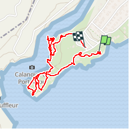

Length
3 km

Max alt
28 m

Uphill gradient
62 m
Km-Effort
3.7 km

Min alt
2 m

Downhill gradient
44 m
Boucle
Yes
Creation date :
2016-09-30 00:00:00.0
Updated on :
2016-09-30 00:00:00.0
1h56
Difficulty : Very easy

FREE GPS app for hiking
 SityTrail
IGN / Geographical institutes
SityTrail Plus
The world is yours!
About
Trail Walking of 3 km to be discovered at Provence-Alpes-Côte d'Azur, Bouches-du-Rhône, Cassis. This trail is proposed by martinemarie.
Description
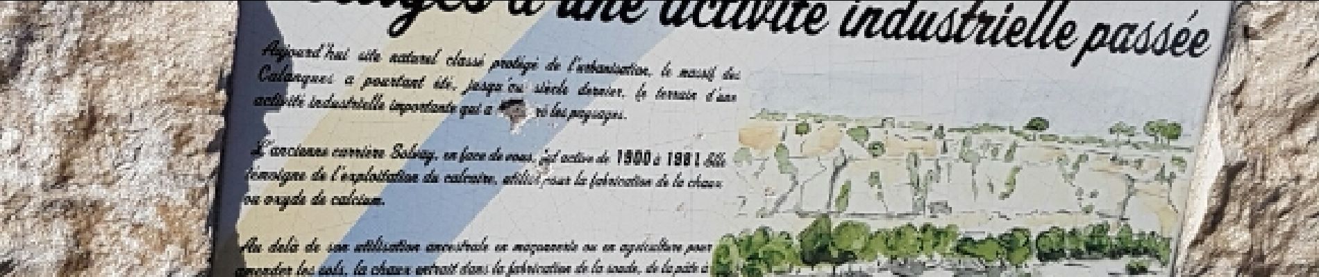
Petite balade mais des vues magnifiques
Photos


Positioning
Country:
France
Region :
Provence-Alpes-Côte d'Azur
Department/Province :
Bouches-du-Rhône
Municipality :
Cassis
Location:
Unknown
Start:(Dec)
Start:(UTM)
704753 ; 4786776 (31T) N.
Comments
bien