


Abbaye de la Prée

jlrayon
User
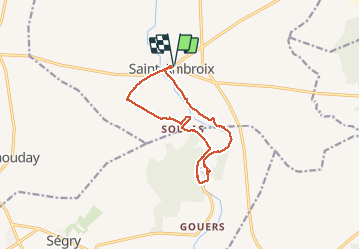

Length
12.7 km

Max alt
157 m

Uphill gradient
112 m
Km-Effort
14.2 km

Min alt
129 m

Downhill gradient
113 m
Boucle
Yes
Creation date :
2016-09-28 00:00:00.0
Updated on :
2016-09-28 00:00:00.0
3h55
Difficulty : Unknown

FREE GPS app for hiking
 SityTrail
IGN / Geographical institutes
SityTrail Plus
The world is yours!
About
Trail Walking of 12.7 km to be discovered at Centre-Loire Valley, Cher, Saint-Ambroix. This trail is proposed by jlrayon.
Description
Abbaye de la Prée
Positioning
Country:
France
Region :
Centre-Loire Valley
Department/Province :
Cher
Municipality :
Saint-Ambroix
Location:
Unknown
Start:(Dec)
Start:(UTM)
433004 ; 5197917 (31T) N.
Comments