


Villetelle -Circuit des capitelles

kephas
User
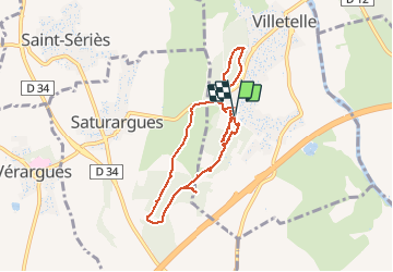

Length
8.5 km

Max alt
65 m

Uphill gradient
85 m
Km-Effort
9.6 km

Min alt
26 m

Downhill gradient
84 m
Boucle
Yes
Creation date :
2016-10-02 00:00:00.0
Updated on :
2016-10-02 00:00:00.0
3h25
Difficulty : Very easy

FREE GPS app for hiking
 SityTrail
IGN / Geographical institutes
SityTrail Plus
The world is yours!
About
Trail Walking of 8.5 km to be discovered at Occitania, Hérault, Villetelle. This trail is proposed by kephas.
Description
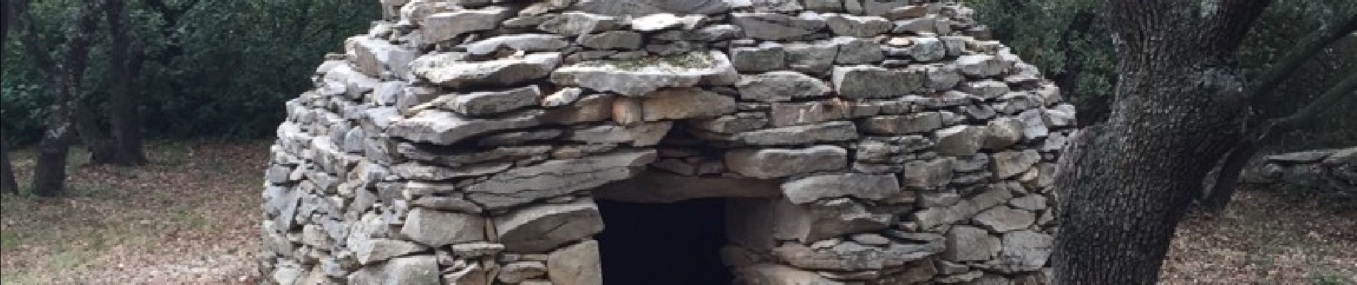
Boucle dans la garrigue et en sous bois à la découverte des capitelles
Photos


Positioning
Country:
France
Region :
Occitania
Department/Province :
Hérault
Municipality :
Villetelle
Location:
Unknown
Start:(Dec)
Start:(UTM)
591173 ; 4841728 (31T) N.
Comments