


candillargues etang de l'or

philcll
User
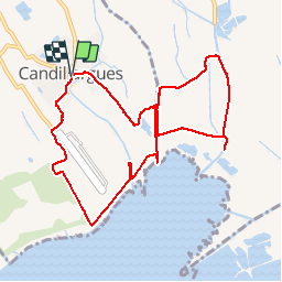

Length
10.6 km

Max alt
6 m

Uphill gradient
24 m
Km-Effort
10.9 km

Min alt
-3 m

Downhill gradient
25 m
Boucle
Yes
Creation date :
2016-10-03 00:00:00.0
Updated on :
2016-10-03 00:00:00.0
2h27
Difficulty : Easy

FREE GPS app for hiking
 SityTrail
IGN / Geographical institutes
SityTrail Plus
The world is yours!
About
Trail Walking of 10.6 km to be discovered at Occitania, Hérault, Candillargues. This trail is proposed by philcll.
Positioning
Country:
France
Region :
Occitania
Department/Province :
Hérault
Municipality :
Candillargues
Location:
Unknown
Start:(Dec)
Start:(UTM)
586242 ; 4830206 (31T) N.
Comments