


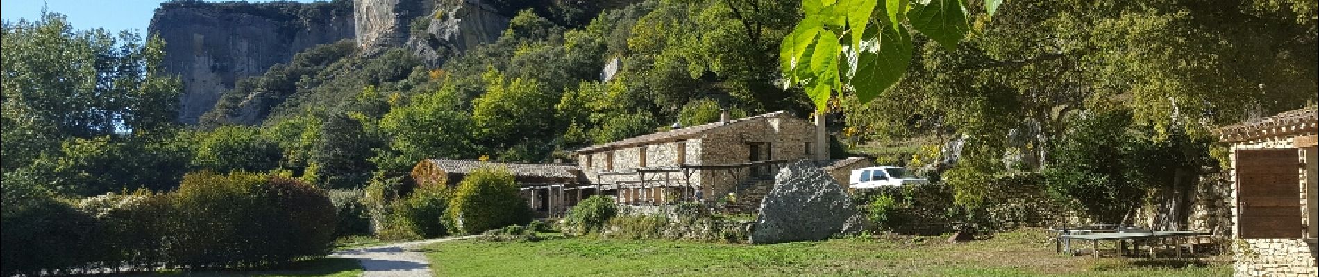
Buoux Aigue Brun

kephas
User
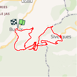

Length
14.7 km

Max alt
584 m

Uphill gradient
446 m
Km-Effort
21 km

Min alt
413 m

Downhill gradient
448 m
Boucle
Yes
Creation date :
2017-02-18 00:00:00.0
Updated on :
2017-02-18 00:00:00.0
4h30
Difficulty : Medium

FREE GPS app for hiking
 SityTrail
IGN / Geographical institutes
SityTrail Plus
The world is yours!
About
Trail Walking of 14.7 km to be discovered at Provence-Alpes-Côte d'Azur, Vaucluse, Buoux. This trail is proposed by kephas.
Photos


Positioning
Country:
France
Region :
Provence-Alpes-Côte d'Azur
Department/Province :
Vaucluse
Municipality :
Buoux
Location:
Unknown
Start:(Dec)
Start:(UTM)
691270 ; 4855897 (31T) N.
Comments