


Sacoue

AndreLACOMBE
User
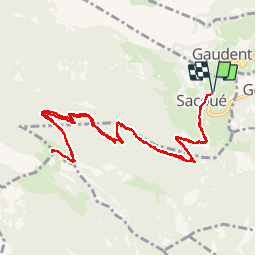

Length
14.6 km

Max alt
1526 m

Uphill gradient
933 m
Km-Effort
27 km

Min alt
587 m

Downhill gradient
932 m
Boucle
Yes
Creation date :
2016-10-28 00:00:00.0
Updated on :
2016-10-28 00:00:00.0
7h07
Difficulty : Difficult

FREE GPS app for hiking
 SityTrail
IGN / Geographical institutes
SityTrail Plus
The world is yours!
About
Trail Walking of 14.6 km to be discovered at Occitania, Hautespyrenees, Sacoué. This trail is proposed by AndreLACOMBE.
Description
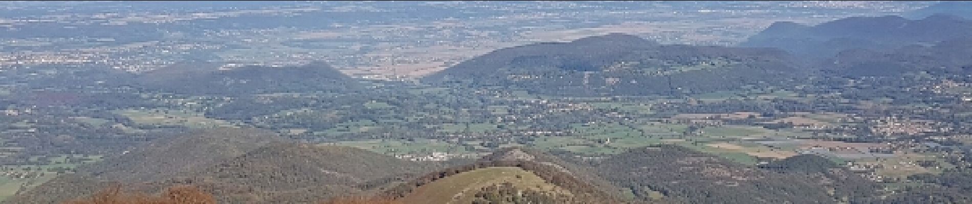
Montee au TOURROC. Rando en forêt, sans grande difficulté hormis la longueur du trajet. Vue splendide depuis le sommet.
Photos


Positioning
Country:
France
Region :
Occitania
Department/Province :
Hautespyrenees
Municipality :
Sacoué
Location:
Unknown
Start:(Dec)
Start:(UTM)
301507 ; 4762441 (31T) N.
Comments