


COL DE LA BIGUE - ND DE LA LIESSE - CHAPELLE ST PRIEST

jpb83
User

Length
17.2 km

Max alt
1074 m

Uphill gradient
590 m
Km-Effort
25 km

Min alt
627 m

Downhill gradient
589 m
Boucle
Yes
Creation date :
2016-10-29 00:00:00.0
Updated on :
2016-10-29 00:00:00.0
5h12
Difficulty : Medium

FREE GPS app for hiking
 SityTrail
IGN / Geographical institutes
SityTrail Plus
The world is yours!
About
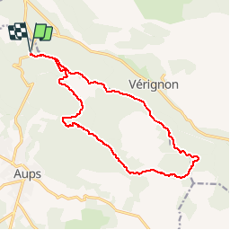
Trail Walking of 17.2 km to be discovered at Provence-Alpes-Côte d'Azur, Var, Aups. This trail is proposed by jpb83.
Description
Départ du Col de la Bigue entre Aups et Bauduen
Positioning
Country:
France
Region :
Provence-Alpes-Côte d'Azur
Department/Province :
Var
Municipality :
Aups
Location:
Unknown
Start:(Dec)
Start:(UTM)
276402 ; 4838083 (32T) N.
Comments