


MAULEON-BAROUSSE

AndreLACOMBE
User

Length
8.2 km

Max alt
774 m

Uphill gradient
317 m
Km-Effort
12.4 km

Min alt
574 m

Downhill gradient
320 m
Boucle
Yes
Creation date :
2016-10-31 00:00:00.0
Updated on :
2016-10-31 00:00:00.0
3h03
Difficulty : Easy

FREE GPS app for hiking
 SityTrail
IGN / Geographical institutes
SityTrail Plus
The world is yours!
About
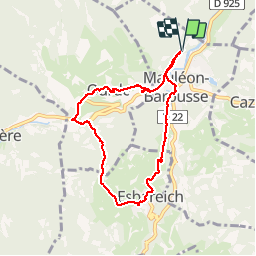
Trail Walking of 8.2 km to be discovered at Occitania, Hautespyrenees, Mauléon-Barousse. This trail is proposed by AndreLACOMBE.
Description
Circuit agréable en campagne autour de Mauléon.
Photos


Positioning
Country:
France
Region :
Occitania
Department/Province :
Hautespyrenees
Municipality :
Mauléon-Barousse
Location:
Unknown
Start:(Dec)
Start:(UTM)
301690 ; 4759673 (31T) N.
Comments