Trail Walking Fontenailles - BMF-161029 - Fontenailles-ChapelleGauthier - Photo

BMF-161029 - Fontenailles-ChapelleGauthier

 randodan
randodan

User

© OpenStreetMap contributors
Length
Length
16 km
Max alt
Max alt
132 m
Uphill gradient
Uphill gradient
169 m
Km-Effort
Km-Effort  
18.3 km
Min alt
Min alt
90 m
Downhill gradient
Downhill gradient
178 m
Boucle
Boucle
Yes
Creation date :
2016-12-11 00:00:00.0
Updated on :
2016-12-11 00:00:00.0

(0 Reviews)

Walking
Walking
5h30
Difficulty : Very easy

Scan this QR Code to open this trail in the SityTrail application

FREE GPS app for hiking

Logo SityTrail SityTrail

IGN / Geographical institutes

Download SityTrail from the App Store Download SityTrail from Google Play

Logo SityTrail SityTrail World

The world is yours!

Download SityTrail from the App Store Download SityTrail from Google Play Download SityTrail on Huawei AppGallery

About

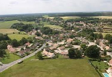
Trail Walking of 16 km to be discovered at Ile-de-France, Seine-et-Marne, Fontenailles. This trail is proposed by randodan.

Description

Fontenailles - La Chapelle-Gauthier<br>
- 29 octobre 2016 -<br>
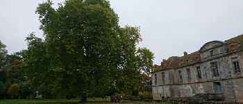
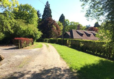
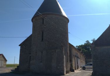
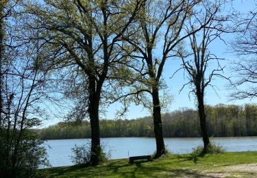
Départ du stade de Fontenailles, 9h30. Cap sur les Etangs de Villefermoy . Après une bonne traversée de la Forêt de Villefermoy, remontons sur la Chapelle-Gauthier et faisons le tour de son château.<br>
Midi et demi à l'Olivier, un très bon resto que nous avons tous apprécié.<br>
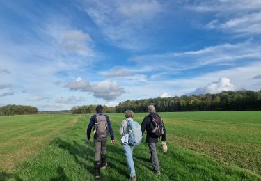
L'après-midi, retour au plus court pour arriver à 16h10 aux voitures, et terminer cette bonne journée chez Michèle et Bernard avec cidre et petites gâteries.

Elevation profile

Photos

Points of interest

Point of interest La Chapelle-Gauthier - Le Château de la Chapelle-Gauthier - Photo
randodan
LA CHAPELLE-GAUTHIER 

Positioning

Country:
France
Region :
Ile-de-France
Department/Province :
Seine-et-Marne
Municipality :
Fontenailles
Location:
Unknown
Start:(UTM)
496372 ; 5378050 (31U) N.

Trails nearby

Trail Walking Fontenailles - Les vallons de Fontenailles - Photo
Walking
BrunoMounier

Walking

Fontenailles, Ile-de-France, Seine-et-Marne, France
8.1 km | 9.4 km-effort
Unknown
Yes
Trail Walking Nangis - Nangis - Photo
Walking
chouk1

Walking

Easy
(1)
Nangis, Ile-de-France, Seine-et-Marne, France
18.8 km | 20 km-effort
Unknown
No
Trail Walking La Chapelle-Gauthier - Boucle La Chapelle Gauthier par François - Photo
Walking
chessyca

Walking

Easy
La Chapelle-Gauthier, Ile-de-France, Seine-et-Marne, France
20 km | 23 km-effort
4h 35min
Yes
Trail Walking La Chapelle-Rablais - Forêt de Villefermoy - Boucle Sud - Photo
Walking

Walking

Difficult
La Chapelle-Rablais, Ile-de-France, Seine-et-Marne, France
19.6 km | 21 km-effort
3h 27min
Yes
Trail Walking La Chapelle-Gauthier - Grand Grippon.2 - Photo
Walking
pikibangi

Walking

Very difficult
La Chapelle-Gauthier, Ile-de-France, Seine-et-Marne, France
22 km | 24 km-effort
4h 48min
Yes
Trail Walking Fontenailles - Villefermoy - Photo
Walking
joelinou

Walking

Medium
Fontenailles, Ile-de-France, Seine-et-Marne, France
14.9 km | 16.4 km-effort
3h 10min
Yes
Trail Walking Saint-Ouen-en-Brie - JC 04 23 km St Ouen en Brie - Photo
Walking

Walking

Difficult
Saint-Ouen-en-Brie, Ile-de-France, Seine-et-Marne, France
23 km | 25 km-effort
5h 37min
Yes
Trail On foot Fontenailles - Etang de Villefermoys/ Fontenailles - Photo
On foot
francoisep

On foot

Easy
Fontenailles, Ile-de-France, Seine-et-Marne, France
16.5 km | 18.9 km-effort
4h 17min
Yes
Trail Walking Fontenailles - contreforts-de-la-for-t-de-villefermoy - Photo
Walking

Walking

Difficult
Fontenailles, Ile-de-France, Seine-et-Marne, France
23 km | 26 km-effort
6h 0min
Yes


Close
My subscriptions