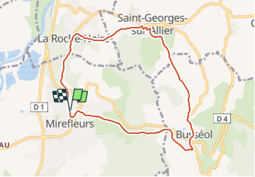
Trail Walking Mirefleurs - Mirefleurs_Busseol - Photo
 jagarnier
jagarnier

User GUIDE

© OpenStreetMap contributors
Length
Length
8.7 km
Max alt
Max alt
582 m
Uphill gradient
Uphill gradient
269 m
Km-Effort
Km-Effort  
12.3 km
Min alt
Min alt
395 m
Downhill gradient
Downhill gradient
267 m
Boucle
Boucle
Yes
Creation date :
2016-11-01 00:00:00.0
Updated on :
2024-11-20 08:41:46.54

(0 Reviews)

Walking
Walking
2h30
Difficulty : Easy

Scan this QR Code to open this trail in the SityTrail application

FREE GPS app for hiking

Logo SityTrail SityTrail

IGN / Geographical institutes

Download SityTrail from the App Store Download SityTrail from Google Play

Logo SityTrail SityTrail Plus

The world is yours!

Download SityTrail from the App Store Download SityTrail from Google Play Download SityTrail on Huawei AppGallery

About

Trail Walking of 8.7 km to be discovered at Auvergne-Rhône-Alpes, Puy-de-Dôme, Mirefleurs. This trail is proposed by jagarnier.

Description

Parmi de très nombreux "villages vignerons" du Val d'Allier, Mirefleurs, La Roche Noire, et Saint Georges sur Allier ne ménagent pas leurs efforts pour faire revivre une viticulture qui pendant longtemps leur raison d'être.
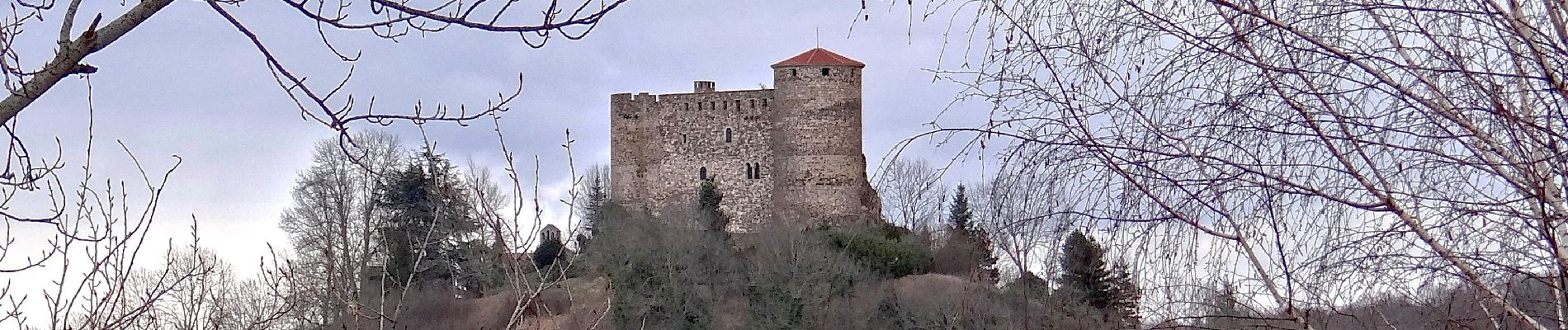
La vue sur le château perché de Busséol est quasi permanente.

Elevation profile

Photos

Positioning

Country:
France
Region :
Auvergne-Rhône-Alpes
Department/Province :
Puy-de-Dôme
Municipality :
Mirefleurs
Location:
Unknown
Start:(UTM)
517462 ; 5060283 (31T) N.


Close
My subscriptions