


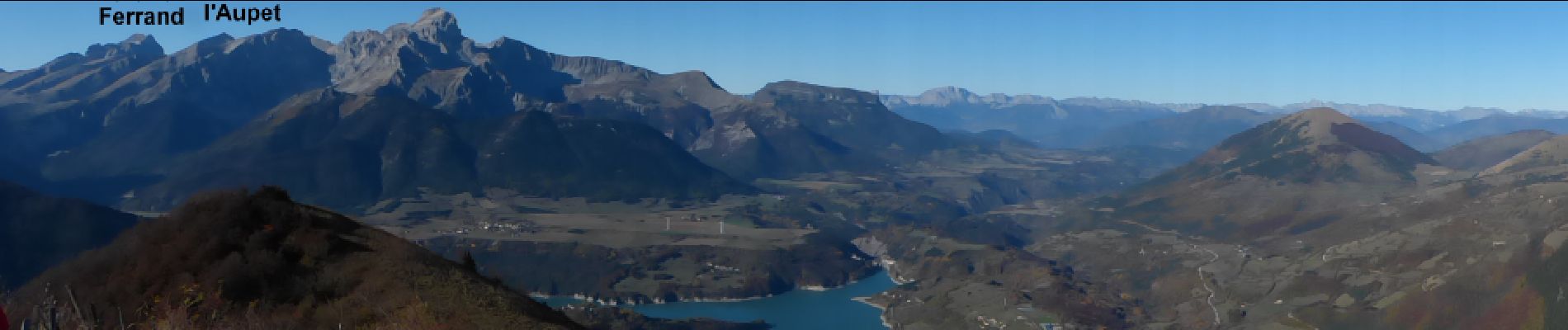
Aspres les corps - Roche Courbe

R@ph
User GUIDE
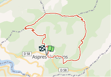

Length
10.6 km

Max alt
1920 m

Uphill gradient
1000 m
Km-Effort
24 km

Min alt
966 m

Downhill gradient
1003 m
Boucle
Yes
Creation date :
2016-11-03 00:00:00.0
Updated on :
2016-11-03 00:00:00.0
4h53
Difficulty : Very difficult

FREE GPS app for hiking
 SityTrail
IGN / Geographical institutes
SityTrail Plus
The world is yours!
About
Trail Walking of 10.6 km to be discovered at Provence-Alpes-Côte d'Azur, Hautes-Alpes, Aspres-lès-Corps. This trail is proposed by R@ph.
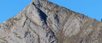
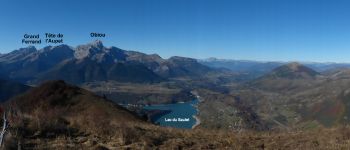
Photos


Positioning
Country:
France
Region :
Provence-Alpes-Côte d'Azur
Department/Province :
Hautes-Alpes
Municipality :
Aspres-lès-Corps
Location:
Unknown
Start:(Dec)
Start:(UTM)
735664 ; 4965318 (31T) N.
Comments
Merci