


golf de roquebrune

cb8310
User
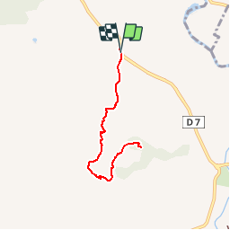

Length
7.5 km

Max alt
104 m

Uphill gradient
188 m
Km-Effort
10 km

Min alt
16 m

Downhill gradient
190 m
Boucle
Yes
Creation date :
2016-11-04 00:00:00.0
Updated on :
2016-11-04 00:00:00.0
2h10
Difficulty : Unknown

FREE GPS app for hiking
 SityTrail
IGN / Geographical institutes
SityTrail Plus
The world is yours!
About
Trail Walking of 7.5 km to be discovered at Provence-Alpes-Côte d'Azur, Var, Roquebrune-sur-Argens. This trail is proposed by cb8310.
Positioning
Country:
France
Region :
Provence-Alpes-Côte d'Azur
Department/Province :
Var
Municipality :
Roquebrune-sur-Argens
Location:
Unknown
Start:(Dec)
Start:(UTM)
311296 ; 4811043 (32T) N.
Comments