Trail Walking Semezanges - circuit des vestiges disparus - Photo

circuit des vestiges disparus

 mpstoop
mpstoop

User

© OpenStreetMap contributors
Length
Length
12.1 km
Max alt
Max alt
616 m
Uphill gradient
Uphill gradient
255 m
Km-Effort
Km-Effort  
15.5 km
Min alt
Min alt
435 m
Downhill gradient
Downhill gradient
264 m
Boucle
Boucle
No
Creation date :
2016-11-09 00:00:00.0
Updated on :
2016-11-09 00:00:00.0

(2 Reviews)

Walking
Walking
3h06
Difficulty : Medium

Scan this QR Code to open this trail in the SityTrail application

FREE GPS app for hiking

Logo SityTrail SityTrail

IGN / Geographical institutes

Download SityTrail from the App Store Download SityTrail from Google Play

Logo SityTrail SityTrail World

The world is yours!

Download SityTrail from the App Store Download SityTrail from Google Play Download SityTrail on Huawei AppGallery

About

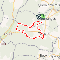
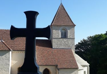
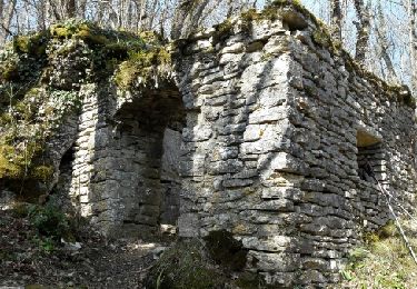
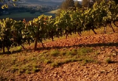
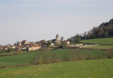
Trail Walking of 12.1 km to be discovered at Bourgogne-Franche-Comté, Côte-d'Or, Semezanges. This trail is proposed by mpstoop.

Description

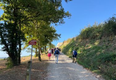
Ce parcours exclusivement boisé,serpente entre différents vestiges des activités humaines,vieux de quelques années à deux milles ans.
Carrière souterraine, ferme,caves,fontaine,enclos de pierres sur plusieurs hectares,bas-reliefs,chapelle,puits,circuit de karting..Tout celà et peut-être d'autres mystères tous enfouis par l'extension de la forêt, vous attendent .
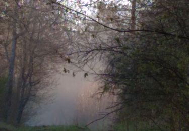
Rencontres possibles : cerf,renards,champignons de grande taille,orchidées, lys,sanglier(attention)! et peut-être même le grand duc.
Afin d'en préserver la magie,ce circuit doit être évité les jours de chasse au bois.
Belle découverte!!

Elevation profile

Photos

Points of interest

Point of interest Semezanges - parc à sanglier - Photo
mpstoop
SEMEZANGES 

Positioning

Country:
France
Region :
Bourgogne-Franche-Comté
Department/Province :
Côte-d'Or
Municipality :
Semezanges
Location:
Unknown
Start:(UTM)
640015 ; 5230482 (31T) N.

Comments

Please log in to post a review or rate the element


randonnée tracée par un sanglier à deux jambes ? 🤔 malgré tout intéressante !


Belle balade mais certaines portions de chemins sont introuvable. On a fait une portion dans les ronces.


Trails nearby

Trail Mountain bike Curley - raidetoto2017 sam - Photo
Mountain bike
Tollard

Mountain bike

Difficult
(1)
Curley, Bourgogne-Franche-Comté, Côte-d'Or, France
67 km | 88 km-effort
7h 2min
Yes
Trail Walking Curtil-Vergy - Abbaye saint Vivant - Photo
Walking
jpbonnemains

Walking

Curtil-Vergy, Bourgogne-Franche-Comté, Côte-d'Or, France
10 km | 14.3 km-effort
2h 43min
No
Trail Walking Gergueil - balcon de l'Ouche - Photo
Walking
mpstoop

Walking

Very difficult
Gergueil, Bourgogne-Franche-Comté, Côte-d'Or, France
38 km | 50 km-effort
9h 28min
No
Trail Walking Chambœuf - chamboeuf - Photo
Walking
miloudominique

Walking

Easy
(1)
Chambœuf, Bourgogne-Franche-Comté, Côte-d'Or, France
14.2 km | 19.4 km-effort
3h 21min
Yes
Trail Mountain bike Chambœuf - chamboeuf 25 kms ruelle vergy - Photo
Mountain bike
baricou1

Mountain bike

Medium
Chambœuf, Bourgogne-Franche-Comté, Côte-d'Or, France
24 km | 30 km-effort
1h 36min
Yes
Trail Walking Semezanges - Autour de Semezanges et Ternant - Photo
Walking
yew

Walking

Easy
Semezanges, Bourgogne-Franche-Comté, Côte-d'Or, France
12.5 km | 16.3 km-effort
3h 32min
Yes
Trail Walking Reulle-Vergy - Val de Vergy - Photo
Walking
mpstoop

Walking

Easy
Reulle-Vergy, Bourgogne-Franche-Comté, Côte-d'Or, France
15 km | 21 km-effort
3h 51min
Yes
Trail Mountain bike Fixin - Raid Bombis 2010 - Photo
Mountain bike
tracegps

Mountain bike

Very difficult
Fixin, Bourgogne-Franche-Comté, Côte-d'Or, France
60 km | 82 km-effort
9h 0min
Yes
Trail Walking Curtil-Vergy - curtyl vergy - Photo
Walking
Montagne71

Walking

Difficult
Curtil-Vergy, Bourgogne-Franche-Comté, Côte-d'Or, France
21 km | 30 km-effort
4h 58min
Yes


Close
My subscriptions