Trail Walking Parent - Parent_Citadelle_Buron_1 - Photo

Parent_Citadelle_Buron_1

 jagarnier
jagarnier

User GUIDE

© OpenStreetMap contributors
Length
Length
10.4 km
Max alt
Max alt
689 m
Uphill gradient
Uphill gradient
344 m
Km-Effort
Km-Effort  
15 km
Min alt
Min alt
447 m
Downhill gradient
Downhill gradient
345 m
Boucle
Boucle
Yes
Creation date :
2017-09-27 00:00:00.0
Updated on :
2023-03-06 16:45:05.065

(0 Reviews)

Walking
Walking
3h00
Difficulty : Medium

Scan this QR Code to open this trail in the SityTrail application

FREE GPS app for hiking

Logo SityTrail SityTrail

IGN / Geographical institutes

Download SityTrail from the App Store Download SityTrail from Google Play

Logo SityTrail SityTrail Plus

The world is yours!

Download SityTrail from the App Store Download SityTrail from Google Play Download SityTrail on Huawei AppGallery

About

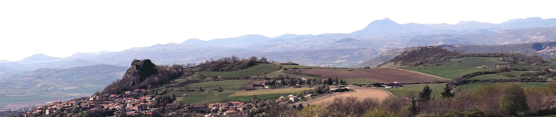
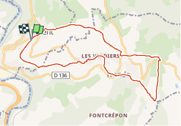
Trail Walking of 10.4 km to be discovered at Auvergne-Rhône-Alpes, Puy-de-Dôme, Parent. This trail is proposed by jagarnier.

Description

En partant de Parent, à mi-pente entre l'Allier et le "nid d'aigle" de Buron, ce parcours est, à la fois, campagnard et villageois. Il rejoint les hauteurs du Puy Rousset pour dominer les ruines du château féodal bâti au XIIIéme siècle par les comtes d'Auvergne.

Elevation profile

Photos

Positioning

Country:
France
Region :
Auvergne-Rhône-Alpes
Department/Province :
Puy-de-Dôme
Municipality :
Parent
Location:
Unknown
Start:(UTM)
517606 ; 5052015 (31T) N.


Close
My subscriptions