


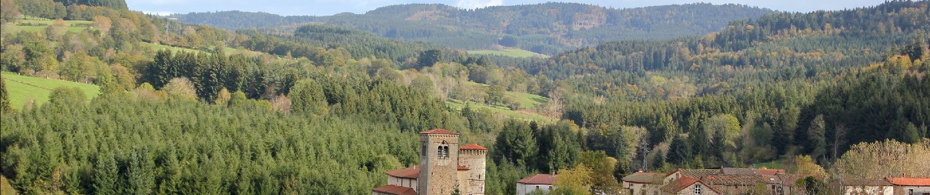
Brousse_Auzelles

jagarnier
User GUIDE
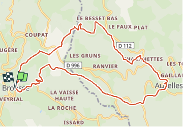

Length
12.5 km

Max alt
801 m

Uphill gradient
415 m
Km-Effort
18 km

Min alt
598 m

Downhill gradient
412 m
Boucle
Yes
Creation date :
2016-11-10 00:00:00.0
Updated on :
2024-05-16 13:44:35.432
3h45
Difficulty : Medium

FREE GPS app for hiking
 SityTrail
IGN / Geographical institutes
SityTrail Plus
The world is yours!
About
Trail Walking of 12.5 km to be discovered at Auvergne-Rhône-Alpes, Puy-de-Dôme, Brousse. This trail is proposed by jagarnier.
Photos

Positioning
Country:
France
Region :
Auvergne-Rhône-Alpes
Department/Province :
Puy-de-Dôme
Municipality :
Brousse
Location:
Unknown
Start:(Dec)
Start:(UTM)
535806 ; 5049844 (31T) N.
Comments