


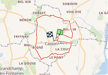
Casson

phila128
User

Length
16.4 km

Max alt
40 m

Uphill gradient
127 m
Km-Effort
18.1 km

Min alt
8 m

Downhill gradient
121 m
Boucle
No
Creation date :
2014-12-10 00:00:00.0
Updated on :
2014-12-10 00:00:00.0
--
Difficulty : Easy

FREE GPS app for hiking
 SityTrail
IGN / Geographical institutes
SityTrail Plus
The world is yours!
About
Trail Walking of 16.4 km to be discovered at Pays de la Loire, Loire-Atlantique, Casson. This trail is proposed by phila128.
Positioning
Country:
France
Region :
Pays de la Loire
Department/Province :
Loire-Atlantique
Municipality :
Casson
Location:
Unknown
Start:(Dec)
Start:(UTM)
609117 ; 5249505 (30T) N.
Comments