


Entre Aurel Rimon et Chanteloube

collot
User
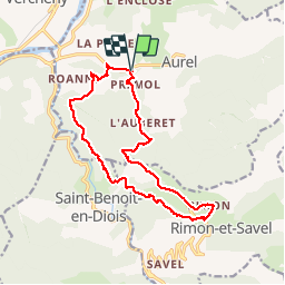

Length
16.7 km

Max alt
1000 m

Uphill gradient
791 m
Km-Effort
27 km

Min alt
325 m

Downhill gradient
790 m
Boucle
Yes
Creation date :
2016-11-14 00:00:00.0
Updated on :
2024-09-28 16:36:03.671
7h05
Difficulty : Medium

FREE GPS app for hiking
 SityTrail
IGN / Geographical institutes
SityTrail Plus
The world is yours!
About
Trail Walking of 16.7 km to be discovered at Auvergne-Rhône-Alpes, Drôme, Aurel. This trail is proposed by collot.
Description
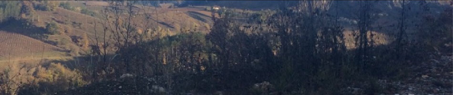
Randonnée sympathique, empruntant un sentier oublié dans le dernier tiers de la rando !
Sentier en balcon sur la Roanne.
Photos


Positioning
Country:
France
Region :
Auvergne-Rhône-Alpes
Department/Province :
Drôme
Municipality :
Aurel
Location:
Unknown
Start:(Dec)
Start:(UTM)
680966 ; 4951362 (31T) N.
Comments