


Bonnoeuvre 2011-05-14

phila128
User
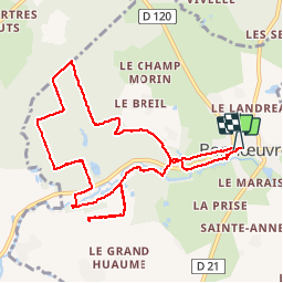

Length
10.3 km

Max alt
60 m

Uphill gradient
130 m
Km-Effort
12 km

Min alt
22 m

Downhill gradient
130 m
Boucle
Yes
Creation date :
2014-12-10 00:00:00.0
Updated on :
2014-12-10 00:00:00.0
--
Difficulty : Very easy

FREE GPS app for hiking
 SityTrail
IGN / Geographical institutes
SityTrail Plus
The world is yours!
About
Trail Walking of 10.3 km to be discovered at Pays de la Loire, Loire-Atlantique, Vallons-de-l'Erdre. This trail is proposed by phila128.
Positioning
Country:
France
Region :
Pays de la Loire
Department/Province :
Loire-Atlantique
Municipality :
Vallons-de-l'Erdre
Location:
Bonnœuvre
Start:(Dec)
Start:(UTM)
632583 ; 5265299 (30T) N.
Comments