


cascade de chapieu

24nus
User

Length
12.3 km

Max alt
370 m

Uphill gradient
205 m
Km-Effort
15.1 km

Min alt
262 m

Downhill gradient
207 m
Boucle
Yes
Creation date :
2014-12-10 00:00:00.0
Updated on :
2014-12-10 00:00:00.0
3h20
Difficulty : Easy

FREE GPS app for hiking
 SityTrail
IGN / Geographical institutes
SityTrail Plus
The world is yours!
About
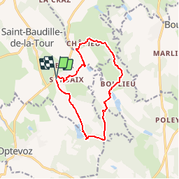
Trail Walking of 12.3 km to be discovered at Auvergne-Rhône-Alpes, Isère, Saint-Baudille-de-la-Tour. This trail is proposed by 24nus.
Description
Randonnée facile vers la cascade de chapieu.
Vous croiserez un très joli lavoir pendant cette promenade.
Positioning
Country:
France
Region :
Auvergne-Rhône-Alpes
Department/Province :
Isère
Municipality :
Saint-Baudille-de-la-Tour
Location:
Unknown
Start:(Dec)
Start:(UTM)
682699 ; 5071805 (31T) N.
Comments