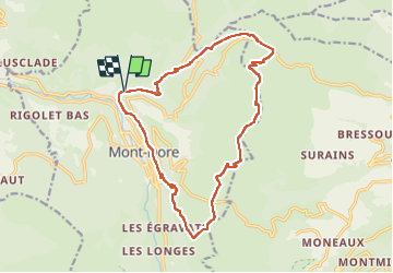
Trail Walking Mont-Dore - Mont_Dore_Cascades - Photo
 jagarnier
jagarnier

User GUIDE

© OpenStreetMap contributors
Length
Length
16.8 km
Max alt
Max alt
1727 m
Uphill gradient
Uphill gradient
921 m
Km-Effort
Km-Effort  
29 km
Min alt
Min alt
997 m
Downhill gradient
Downhill gradient
916 m
Boucle
Boucle
Yes
Creation date :
2016-12-01 00:00:00.0
Updated on :
2025-04-20 13:02:01.401

(0 Reviews)

Walking
Walking
5h15
Difficulty : Difficult

Scan this QR Code to open this trail in the SityTrail application

FREE GPS app for hiking

Logo SityTrail SityTrail

IGN / Geographical institutes

Download SityTrail from the App Store Download SityTrail from Google Play

Logo SityTrail SityTrail Plus

The world is yours!

Download SityTrail from the App Store Download SityTrail from Google Play Download SityTrail on Huawei AppGallery

About

Trail Walking of 16.8 km to be discovered at Auvergne-Rhône-Alpes, Puy-de-Dôme, Mont-Dore. This trail is proposed by jagarnier.

Description

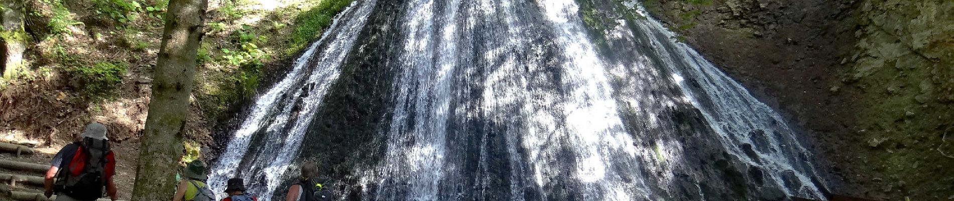
Symbole de fraîcheur et de pureté, bruyantes et insouciantes, les cascades attirent les visiteurs depuis plus d'un siècle.
L’une des plus belles randonnées de toute la région. Vous  découvrirez  4 belles cascades en parcourant les chemins de crêtes de part et d’autre du col de la Croix Saint-Robert et du col de la Croix-Morand. Des panoramas splendides.

Elevation profile

Photos

Positioning

Country:
France
Region :
Auvergne-Rhône-Alpes
Department/Province :
Puy-de-Dôme
Municipality :
Mont-Dore
Location:
Unknown
Start:(UTM)
484661 ; 5048333 (31T) N.


Close
My subscriptions