


ev3compiegne lacroix st ouentransoise

gilbertdu60
User
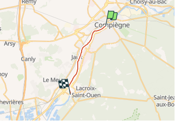

Length
8.6 km

Max alt
38 m

Uphill gradient
51 m
Km-Effort
9.3 km

Min alt
27 m

Downhill gradient
50 m
Boucle
No
Creation date :
2016-12-02 00:00:00.0
Updated on :
2016-12-02 00:00:00.0
--
Difficulty : Unknown

FREE GPS app for hiking
 SityTrail
IGN / Geographical institutes
SityTrail Plus
The world is yours!
About
Trail Other activity of 8.6 km to be discovered at Hauts-de-France, Oise, Compiègne. This trail is proposed by gilbertdu60.
Positioning
Country:
France
Region :
Hauts-de-France
Department/Province :
Oise
Municipality :
Compiègne
Location:
Unknown
Start:(Dec)
Start:(UTM)
486738 ; 5473780 (31U) N.
Comments