


16 nov 2016 Problème chemin

jpipacific
User
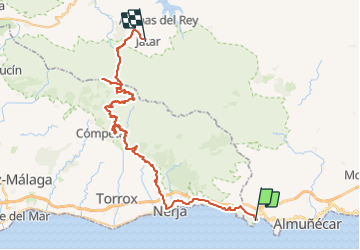

Length
76 km

Max alt
1725 m

Uphill gradient
3058 m
Km-Effort
113 km

Min alt
24 m

Downhill gradient
2167 m
Boucle
No
Creation date :
2018-04-25 00:00:00.0
Updated on :
2019-05-13 17:13:51.261
13h00
Difficulty : Difficult

FREE GPS app for hiking
 SityTrail
IGN / Geographical institutes
SityTrail Plus
The world is yours!
About
Trail Moto cross of 76 km to be discovered at Andalusia, Granada, Almuñécar. This trail is proposed by jpipacific.
Description
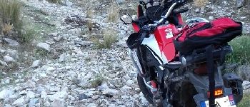
Chemin a ne pas prendre
Photos


Positioning
Country:
Spain
Region :
Andalusia
Department/Province :
Granada
Municipality :
Almuñécar
Location:
Unknown
Start:(Dec)
Start:(UTM)
432097 ; 4066034 (30S) N.
Comments