Trail Walking Vic-le-Comte - 
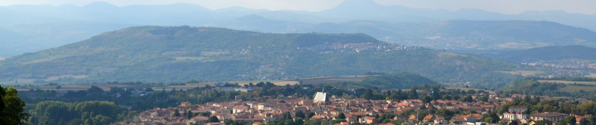
Vic_le_Comte_Bassin_2 - Photo
 jagarnier
jagarnier

User GUIDE

© OpenStreetMap contributors
Length
Length
12.5 km
Max alt
Max alt
646 m
Uphill gradient
Uphill gradient
311 m
Km-Effort
Km-Effort  
16.6 km
Min alt
Min alt
447 m
Downhill gradient
Downhill gradient
310 m
Boucle
Boucle
Yes
Creation date :
2016-12-06 00:00:00.0
Updated on :
2023-02-23 07:43:49.937

(1 Reviews)

Walking
Walking
3h45
Difficulty : Medium

Scan this QR Code to open this trail in the SityTrail application

FREE GPS app for hiking

Logo SityTrail SityTrail

IGN / Geographical institutes

Download SityTrail from the App Store Download SityTrail from Google Play

Logo SityTrail SityTrail Plus

The world is yours!

Download SityTrail from the App Store Download SityTrail from Google Play Download SityTrail on Huawei AppGallery

About

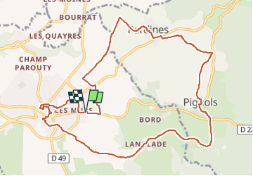
Trail Walking of 12.5 km to be discovered at Auvergne-Rhône-Alpes, Puy-de-Dôme, Vic-le-Comte. This trail is proposed by jagarnier.

Description

Une randonnée riche pour ses bâtiments historiques, sa diversité géologique, la faune et flore de la forêt de la Comté ou encore pour ses 4 ruisseaux qui parcourent ce territoire et son patrimoine rural lié à la vigne.
Le détour par Vic le Comte permet de découvrir le village.

Elevation profile

Photos

Positioning

Country:
France
Region :
Auvergne-Rhône-Alpes
Department/Province :
Puy-de-Dôme
Municipality :
Vic-le-Comte
Location:
Unknown
Start:(UTM)
519885 ; 5054415 (31T) N.

Comments

Please log in to post a review or rate the element


Close
My subscriptions