


Trets sentier des vignerons

mhetpierre
User
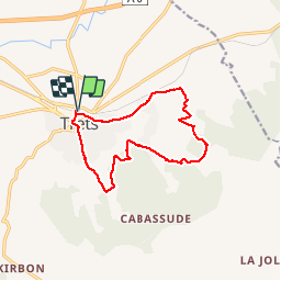

Length
13 km

Max alt
422 m

Uphill gradient
276 m
Km-Effort
16.6 km

Min alt
242 m

Downhill gradient
276 m
Boucle
Yes
Creation date :
2018-08-18 15:29:57.507
Updated on :
2018-08-18 15:29:57.507
3h37
Difficulty : Easy

FREE GPS app for hiking
 SityTrail
IGN / Geographical institutes
SityTrail Plus
The world is yours!
About
Trail Walking of 13 km to be discovered at Provence-Alpes-Côte d'Azur, Bouches-du-Rhône, Trets. This trail is proposed by mhetpierre.
Positioning
Country:
France
Region :
Provence-Alpes-Côte d'Azur
Department/Province :
Bouches-du-Rhône
Municipality :
Trets
Location:
Unknown
Start:(Dec)
Start:(UTM)
717264 ; 4814223 (31T) N.
Comments