


Bois de Mounier

kephas
User
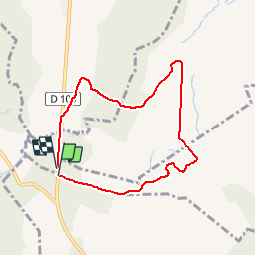

Length
7.1 km

Max alt
206 m

Uphill gradient
114 m
Km-Effort
8.6 km

Min alt
128 m

Downhill gradient
117 m
Boucle
Yes
Creation date :
2016-12-18 00:00:00.0
Updated on :
2016-12-18 00:00:00.0
1h53
Difficulty : Easy

FREE GPS app for hiking
 SityTrail
IGN / Geographical institutes
SityTrail Plus
The world is yours!
About
Trail Walking of 7.1 km to be discovered at Occitania, Hérault, Guzargues. This trail is proposed by kephas.
Positioning
Country:
France
Region :
Occitania
Department/Province :
Hérault
Municipality :
Guzargues
Location:
Unknown
Start:(Dec)
Start:(UTM)
573007 ; 4844129 (31T) N.
Comments