


22dec

mumbly7
User
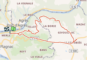

Length
10.9 km

Max alt
460 m

Uphill gradient
290 m
Km-Effort
14.7 km

Min alt
231 m

Downhill gradient
290 m
Boucle
Yes
Creation date :
2016-12-22 00:00:00.0
Updated on :
2016-12-22 00:00:00.0
1h20
Difficulty : Unknown

FREE GPS app for hiking
 SityTrail
IGN / Geographical institutes
SityTrail Plus
The world is yours!
About
Trail Other activity of 10.9 km to be discovered at Occitania, Aveyron, Flagnac. This trail is proposed by mumbly7.
Positioning
Country:
France
Region :
Occitania
Department/Province :
Aveyron
Municipality :
Flagnac
Location:
Unknown
Start:(Dec)
Start:(UTM)
440446 ; 4939898 (31T) N.
Comments