


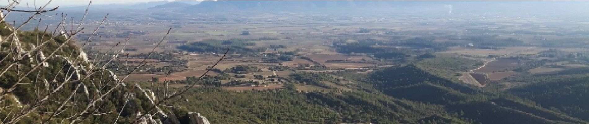
l'ermitage de Saint Ser

amiral13
User GUIDE
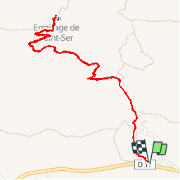

Length
3.2 km

Max alt
673 m

Uphill gradient
235 m
Km-Effort
6.3 km

Min alt
405 m

Downhill gradient
235 m
Boucle
Yes
Creation date :
2016-12-31 00:00:00.0
Updated on :
2016-12-31 00:00:00.0
1h25
Difficulty : Very easy

FREE GPS app for hiking
 SityTrail
IGN / Geographical institutes
SityTrail Plus
The world is yours!
About
Trail Walking of 3.2 km to be discovered at Provence-Alpes-Côte d'Azur, Bouches-du-Rhône, Puyloubier. This trail is proposed by amiral13.
Photos


Positioning
Country:
France
Region :
Provence-Alpes-Côte d'Azur
Department/Province :
Bouches-du-Rhône
Municipality :
Puyloubier
Location:
Unknown
Start:(Dec)
Start:(UTM)
713625 ; 4822827 (31T) N.
Comments
Jolie chapelle retapée. On mange bien au relais de Saint-Ser :)
st victoire