Trail Walking Riotord - GR7 E02 SaintMeyras-StBonnetLeFroid - Photo

GR7 E02 SaintMeyras-StBonnetLeFroid

© OpenStreetMap contributors
Length
Length
17.2 km
Max alt
Max alt
1355 m
Uphill gradient
Uphill gradient
638 m
Km-Effort
Km-Effort  
25 km
Min alt
Min alt
948 m
Downhill gradient
Downhill gradient
478 m
Boucle
Boucle
No
Creation date :
2017-03-10 00:00:00.0
Updated on :
2017-03-10 00:00:00.0

(0 Reviews)

Walking
Walking
5h19
Difficulty : Easy

Scan this QR Code to open this trail in the SityTrail application

FREE GPS app for hiking

Logo SityTrail SityTrail

IGN / Geographical institutes

Download SityTrail from the App Store Download SityTrail from Google Play

Logo SityTrail SityTrail World

The world is yours!

Download SityTrail from the App Store Download SityTrail from Google Play Download SityTrail on Huawei AppGallery

About

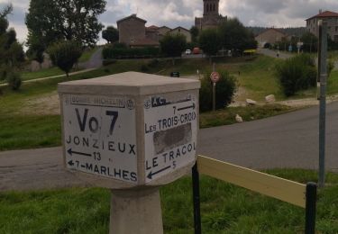
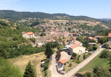
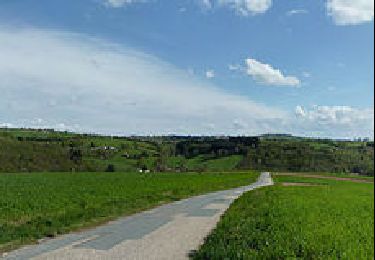
Trail Walking of 17.2 km to be discovered at Auvergne-Rhône-Alpes, Haute-Loire, Riotord. This trail is proposed by richard21220.

Description

îte d'Etape : 9 rue du Vivarais Le Bourg 43290 SAINT BONNET LE FROID Tél 04 71 59 96 08

Gîte d'Etape : Place Jean Béal 43290 SAINT BONNET LE FROID Tél 04 71 59 93 57

Chambres d'Hôtes : Place aux Champignons 43290 SAINT BONNET LE FROID Tél 04 71 59 96 09


Elevation profile

Positioning

Country:
France
Region :
Auvergne-Rhône-Alpes
Department/Province :
Haute-Loire
Municipality :
Riotord
Location:
Unknown
Start:(UTM)
613520 ; 5011693 (31T) N.

Trails nearby

Trail Walking Saint-Régis-du-Coin - Les Balcons de St-Régis-du-Coin - Photo
Walking
tracegps

Walking

Medium
(1)
Saint-Régis-du-Coin, Auvergne-Rhône-Alpes, Loire, France
12.2 km | 16 km-effort
3h 30min
Yes
Trail Walking Saint-Régis-du-Coin - 42 st Régis du coin - Photo
Walking
himba26100

Walking

Medium
Saint-Régis-du-Coin, Auvergne-Rhône-Alpes, Loire, France
16.8 km | 24 km-effort
5h 25min
Yes
Trail Walking Saint-Sauveur-en-Rue - St Sauveur en Rue - Photo
Walking
GPit42

Walking

Medium
Saint-Sauveur-en-Rue, Auvergne-Rhône-Alpes, Loire, France
16.9 km | 25 km-effort
5h 9min
Yes
Trail Walking Saint-Sauveur-en-Rue - La Taillairdine 2013 - St Sauveur en Rue - Photo
Walking
tracegps

Walking

Medium
Saint-Sauveur-en-Rue, Auvergne-Rhône-Alpes, Loire, France
25 km | 39 km-effort
7h 0min
Yes
Trail Walking Saint-Régis-du-Coin - Saint régis du coin 2014 - Photo
Walking
grfamily

Walking

Very easy
(1)
Saint-Régis-du-Coin, Auvergne-Rhône-Alpes, Loire, France
17.7 km | 26 km-effort
5h 25min
Yes
Trail Snowshoes Saint-Régis-du-Coin - Les Balcons de St-Régis-du-Coin - Photo
Snowshoes
tracegps

Snowshoes

Difficult
Saint-Régis-du-Coin, Auvergne-Rhône-Alpes, Loire, France
12.2 km | 16 km-effort
4h 0min
Yes
Trail Mountain bike Saint-Régis-du-Coin - Les Balcons de St-Régis-du-Coin - Photo
Mountain bike
tracegps

Mountain bike

Difficult
(1)
Saint-Régis-du-Coin, Auvergne-Rhône-Alpes, Loire, France
12.2 km | 16 km-effort
1h 30min
Yes
Trail Mountain bike Riotord - Ru de Saint Meyras - Riotord - Photo
Mountain bike
tracegps

Mountain bike

Difficult
Riotord, Auvergne-Rhône-Alpes, Haute-Loire, France
14.8 km | 20 km-effort
1h 30min
Yes
Trail Walking Riotord - Ru de Saint Meyras - Riotord - Photo
Walking
tracegps

Walking

Difficult
Riotord, Auvergne-Rhône-Alpes, Haute-Loire, France
14.8 km | 20 km-effort
4h 0min
Yes


Close
My subscriptions