


Mon Compostelle troisième étape

Ardeiserois
User
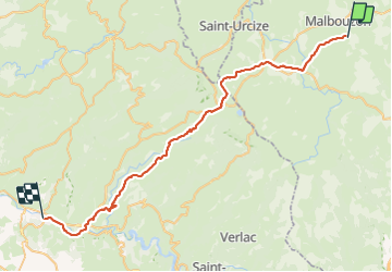

Length
49 km

Max alt
1369 m

Uphill gradient
863 m
Km-Effort
64 km

Min alt
334 m

Downhill gradient
1716 m
Boucle
No
Creation date :
2017-01-09 00:00:00.0
Updated on :
2017-01-09 00:00:00.0
10h32
Difficulty : Very difficult

FREE GPS app for hiking
 SityTrail
IGN / Geographical institutes
SityTrail Plus
The world is yours!
About
Trail Walking of 49 km to be discovered at Occitania, Lozère, Prinsuéjols-Malbouzon. This trail is proposed by Ardeiserois.
Description
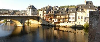
Troisième étape :
Les Gentianes Espalion vendredi 25/09/2009
Départ 7h34, arrivée 18h06
Photos


Positioning
Country:
France
Region :
Occitania
Department/Province :
Lozère
Municipality :
Prinsuéjols-Malbouzon
Location:
Prinsuéjols
Start:(Dec)
Start:(UTM)
511572 ; 4948050 (31T) N.
Comments