


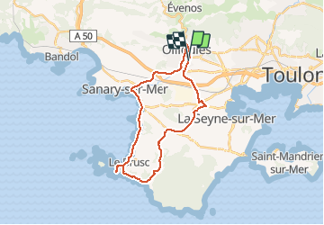
ollioules sanary ollioules

topolino
User

Length
28 km

Max alt
91 m

Uphill gradient
287 m
Km-Effort
32 km

Min alt
-1 m

Downhill gradient
284 m
Boucle
Yes
Creation date :
2017-01-08 00:00:00.0
Updated on :
2017-01-08 00:00:00.0
1h22
Difficulty : Easy

FREE GPS app for hiking
 SityTrail
IGN / Geographical institutes
SityTrail Plus
The world is yours!
About
Trail Running of 28 km to be discovered at Provence-Alpes-Côte d'Azur, Var, Ollioules. This trail is proposed by topolino.
Positioning
Country:
France
Region :
Provence-Alpes-Côte d'Azur
Department/Province :
Var
Municipality :
Ollioules
Location:
Unknown
Start:(Dec)
Start:(UTM)
731765 ; 4779566 (31T) N.
Comments