


Le Tour des Opies Aureille

kephas
User
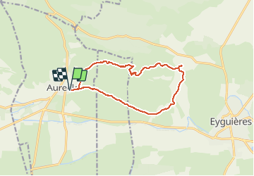

Length
13.5 km

Max alt
479 m

Uphill gradient
416 m
Km-Effort
19 km

Min alt
124 m

Downhill gradient
416 m
Boucle
Yes
Creation date :
2017-01-11 00:00:00.0
Updated on :
2017-01-11 00:00:00.0
5h23
Difficulty : Medium

FREE GPS app for hiking
 SityTrail
IGN / Geographical institutes
SityTrail Plus
The world is yours!
About
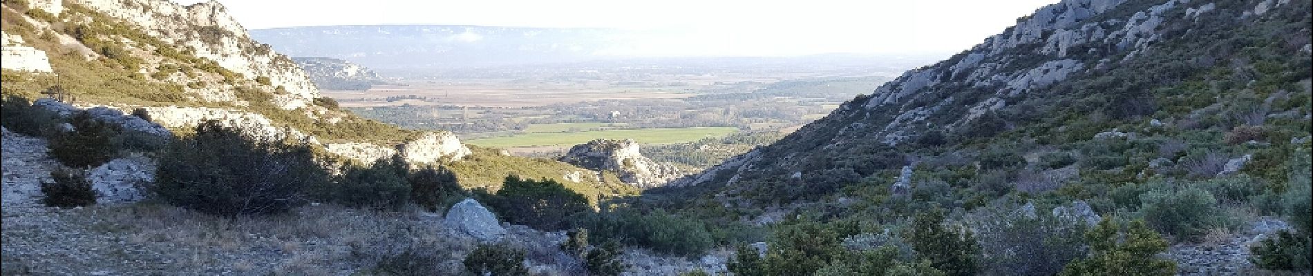
Trail Walking of 13.5 km to be discovered at Provence-Alpes-Côte d'Azur, Bouches-du-Rhône, Aureille. This trail is proposed by kephas.
Photos


Positioning
Country:
France
Region :
Provence-Alpes-Côte d'Azur
Department/Province :
Bouches-du-Rhône
Municipality :
Aureille
Location:
Unknown
Start:(Dec)
Start:(UTM)
657212 ; 4841071 (31T) N.
Comments