


stanneux nord est

Mullender
User
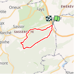

Length
8.2 km

Max alt
373 m

Uphill gradient
245 m
Km-Effort
11.5 km

Min alt
192 m

Downhill gradient
243 m
Boucle
Yes
Creation date :
2017-01-25 00:00:00.0
Updated on :
2017-01-25 00:00:00.0
1h51
Difficulty : Medium

FREE GPS app for hiking
 SityTrail
IGN / Geographical institutes
SityTrail Plus
The world is yours!
About
Trail Walking of 8.2 km to be discovered at Wallonia, Liège, Theux. This trail is proposed by Mullender.
Positioning
Country:
Belgium
Region :
Wallonia
Department/Province :
Liège
Municipality :
Theux
Location:
Polleur
Start:(Dec)
Start:(UTM)
703965 ; 5601921 (31U) N.
Comments