Trail Walking Ventosa - Mon Compostelle Vingtième étape - Photo

Mon Compostelle Vingtième étape

© OpenStreetMap contributors
Length
Length
55 km
Max alt
Max alt
825 m
Uphill gradient
Uphill gradient
874 m
Km-Effort
Km-Effort  
66 km
Min alt
Min alt
485 m
Downhill gradient
Downhill gradient
744 m
Boucle
Boucle
No
Creation date :
2017-02-01 00:00:00.0
Updated on :
2017-02-01 00:00:00.0

(0 Reviews)

Walking
Walking
10h50
Difficulty : Very difficult

Scan this QR Code to open this trail in the SityTrail application

FREE GPS app for hiking

Logo SityTrail SityTrail

IGN / Geographical institutes

Download SityTrail from the App Store Download SityTrail from Google Play

Logo SityTrail SityTrail Plus

The world is yours!

Download SityTrail from the App Store Download SityTrail from Google Play Download SityTrail on Huawei AppGallery

About

Trail Walking of 55 km to be discovered at Rioja, Unknown, Ventosa. This trail is proposed by Ardeiserois.

Description

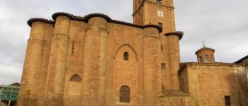
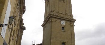
Vingième étape,lundi 12 octobre 2009 Ventosa / Belorado :
Départ : 7h25,
Arrivée :18h15

Elevation profile

Photos

Points of interest

Point of interest Ventosa - Ventosa - Photo
Ardeiserois
VENTOSA 
Point of interest Nájera - Nàjera - Photo
Ardeiserois
NÁJERA 
Point of interest Azofra - Azofra - Photo
Ardeiserois
AZOFRA 
Point of interest Santo Domingo de la Calzada - Santo Domingo de la Calzada - Photo
Ardeiserois
SANTO DOMINGO DE LA CALZADA 
Point of interest Belorado - Belorado - Photo
Ardeiserois
BELORADO 

Positioning

Country:
Spain
Region :
Rioja
Department/Province :
Unknown
Municipality :
Ventosa
Location:
Unknown
Start:(UTM)
530829 ; 4694748 (30T) N.


Close
My subscriptions